")
Spatial Cave Mapping in Bulgaria
Tanya Slavova, Atanas Rusev, Asparuh Kamburov
Caves are natural underground spaces formed and shaped over millions of years. Usually part of bigger caverns, they give a first-hand view of water, biology, oil and other subsurface distributions as well as a glimpse of the past when they perhaps offered a shelter or sanctuary. Therefore, when exploring a cave, it is useful to not only collect geometric information such as gallery dimensions and directions but also to take photographs and notes of any specific features of interest. Since safe storage, easy management and proper representation of spatial data can be difficult using traditional methods, these are all key requirements in the search for modern solution.
Modern Methods and Devices for Mapping Underground Galleries and Natural Caves
Eng. Tanya Slavova
Abstract: It is made a review of the classical techniques and devices used for mapping underground galleries and natural caves. A new method is supposed and realized by the means of modern technologies in the Pepelyankata cave nearby the village of Bosnek, Pernik Province.
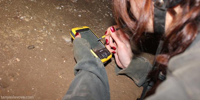
A GPS receiver is used to determine the coordinates of an initial point, which accuracy is later improved by postprocessing. Another device - a combination between a laser rangefinder, a compass and an inclinometer, is used to measure the polygon and certain points inside the cave. All of the measurements are transferred wirelessly to a PDA device and represented by a suitable field software with GIS capabilities. Some other data, including photos made by the PDA’s integrated camera, is collected as an additional attribute information about the points.
Back in the office, it is built-up a TIN model to define the main direction of the cave, its surface, volume and other morphological features. It is also compared with the results of a previous mapping of the cave which is done by other means, to figure out the advantages and disadvantages of the supposed method. The model is also drawn on an orthophoto map of the region in order to find relations between the geological features of the ground and cave’s morphology.