")
GIM INTERNATIONAL Magazine, Issue 3, Volume 27, March 2013
Spatial Cave Mapping in Bulgaria
There is no translation available.
Tanya Slavova, Atanas Rusev, Asparuh Kamburov
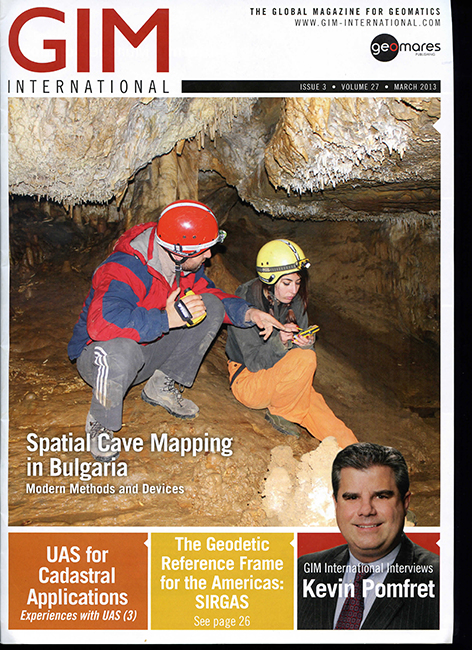
Caves are natural underground spaces formed and shaped over millions of years. Usually part of bigger caverns, they give a first-hand view of water, biology, oil and other subsurface distributions as well as a glimpse of the past when they perhaps offered a shelter or sanctuary. Therefore, when exploring a cave, it is useful to not only collect geometric information such as gallery dimensions and directions but also to take photographs and notes of any specific features of interest. Since safe storage, easy management and proper representation of spatial data can be difficult using traditional methods, these are all key requirements in the search for modern solution.
Tagged under
Download attachments:
- Spatial Cave Mapping in Bulgaria (1344 Downloads)
Leave a comment
Make sure you enter all the required information, indicated by an asterisk (*). HTML code is not allowed.